Reason 1: the Mini 2 does not have a 120 meter altitude limit in the EU
New EU regulation states that every new drone sold on or after January 1, 2024 should be limited to a maximum altitude of 120 meters, and DJI now actually enforces this via software. But here's the kicker: the Mini 2 is legally considered as a 'legacy' drone and can still fly up to an altitude of 500 meters. Admittedly, for most types of flights a 120 meter limit is not a big deal, but if you live in a hilly or mountainous area, or use your drone for mapping-purposes or high-altitude imagery, this could become an issue.
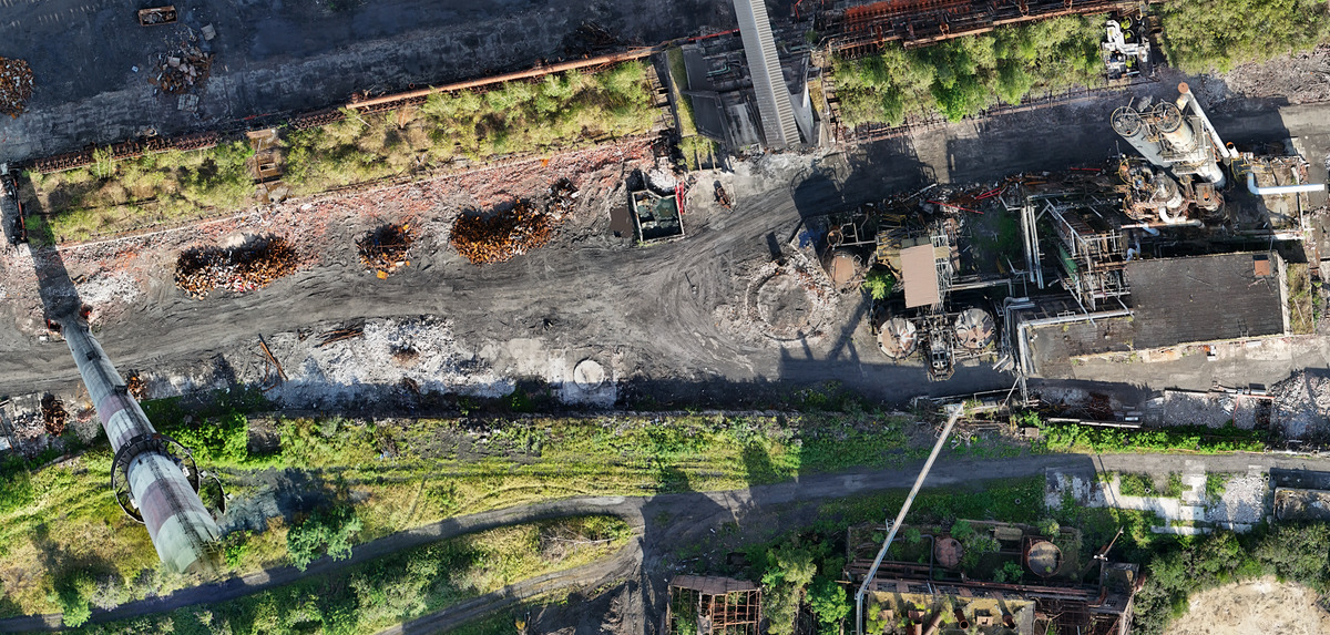
I used the Mini 2 extensively for creating aerial maps of abandoned factories. I would fly over the area in straight lines, make a picture every few meters, and stitch those images together to form a large and detailed map. But when I tried this same technique with the DJI Mini 4 Pro, it became quickly apparent that 120 meters is not high enough for drone mapping. At an altitude of 120m there the perspective of the buildings changes drastically in every shot, leading to an odd-looking map full of perspective- and stitching-issues:
 Notice how the chimney on the left disappears and the buildings on the top right have another perspective
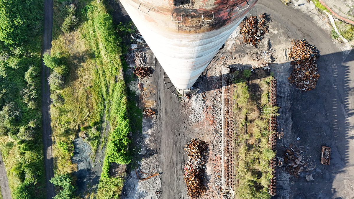
What I also had not accounted for was that the height of the largest chimney on the terrain worked out to be exactly 120m as well... Luckily I caught it just in time (and I hope obstacle avoidance would have otherwise) but my heart sank for a moment.
 Chimney encounter at 120m
This low height 'ceiling' can also be an issue when you encounter birds. If you're ever in a situation where birds are circling (or even attacking) the drone, you should always raise your altitude. The reason is that birds can descend faster than they can ascend, giving your drone an edge. But once you reach the 120 meter limit, you're stuck. Even small birds can reach an altitude of 150 meters.
Reason 2: DJI stopped providing SDK-access for iOS on their latest drones
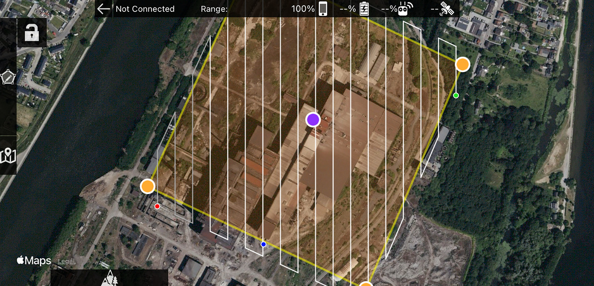
In the past, DJI provided iOS-developers access to the DJI Software Development Kit, which has led to the development of numerous great apps like Litchy and Map Pilot Pro. These apps offer many useful features that DJI Fly does not provide. DJI however stopped providing SDK access for iOS on their latest drones. This means that if you want to perform automated flights to create 2D or even 3D maps, or if you want much more advanced control of your drone, older drones like the Mini 2 might be your only option.
The full list of drones that do support the iOS SDK is as follows: Mini 1/2/SE (v1), Air 2/2s, Phantom 3/4, Inspire 1/2, Mavic 1/2 and Spark.
 Map Pilot Pro allows you to automate your drone-mapping flights
Reason 3: the Mini 2 is smaller, cheaper and more inconspicuous
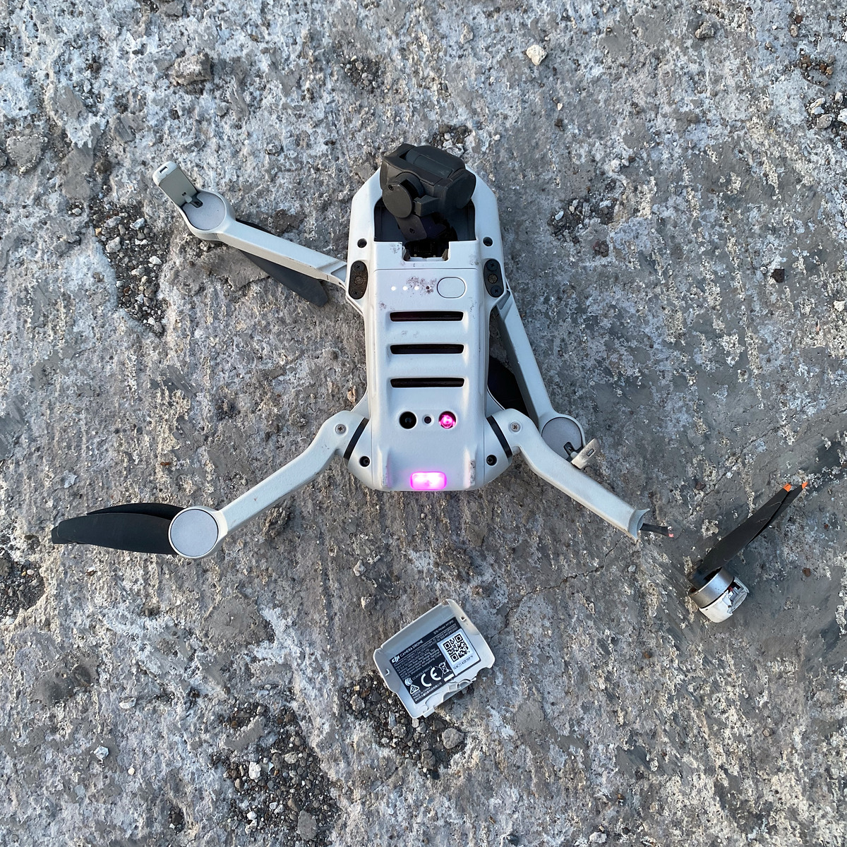
The Mini 2 was a big success for DJI (they even re-released in under a new moniker: Mini 4K). By keeping it small and relatively simple (no obstacle avoidance or tracking) they managed to keep the size and price down, which made it accessible to a much broader audience. Although the size difference between the Mini 2 and the 4 Pro isn't that significant, the Mini 2 has less delicate sensors and smaller batteries which make it more of a throw-in-the-bag. Although you should still fly carefully, of course... ;-)

